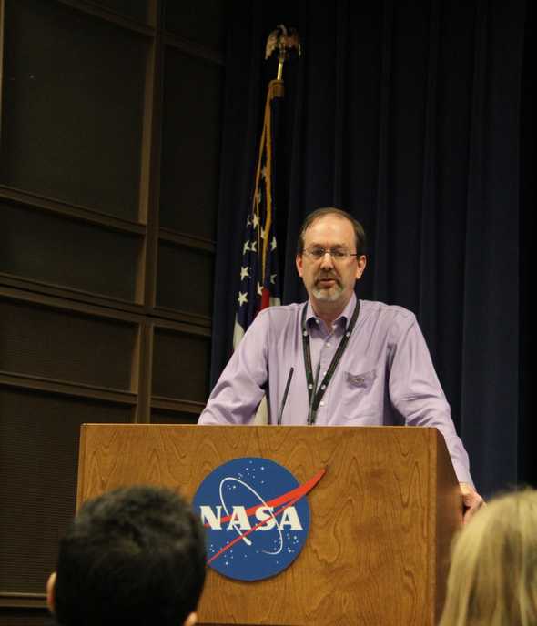
Ken Jucks on missions and aircraft used in NASA's Airborne Earth Science Program
At the NASA Airborne Earth Science Event I was invited to at NASA’s Dryden Flight Research Center, Ken Jucks, Upper Atmosphere Research Program Manager at NASA Headquarters, spoke to us about the satellites and aircraft that are used to answer science questions.
He is involved in a lot of the decisions for the types of science investigations NASA does. Within his first year after graduate school, Jucks was working with an instrument on board one of the NASA airplanes flying over the North Pole. Jucks focuses on the Atmospheric Composition area.
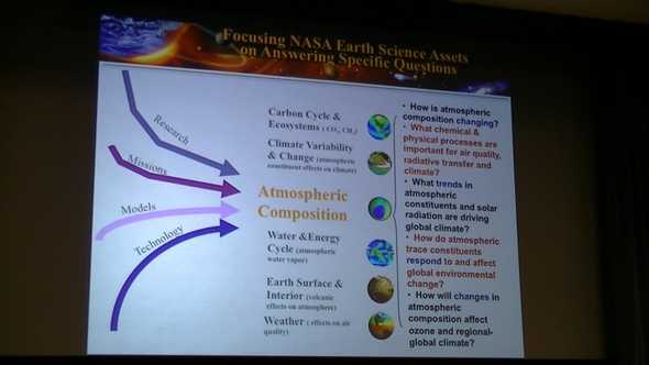
Some questions they are working on in the Atmospheric Composition area include:
- How is atmospheric composition changing?
- What chemical & physical processes are important for air quality, radiactive transfer and climate?
- What trends in atmospheric constituents and solar radiation are driving global climate?
- How do atmospheric trace constituents respond to and affect global environmental change?
- How will changes in atmospheric composition affect ozone and regional-global climate?
All the data gathered from the missions go into models for better understanding and are available to the science community.
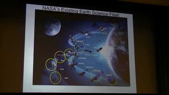
The existing fleet includes: Suomi National Polar-orbiting Partnership (NPP), Aura, Terra, Aqua, Quick Scatterometer (QuikSCAT), CloudSat, Cloud-Aerosol Lidar and Infrared Pathfinder Satellite Observations (CALIPSO), Gravity Recovery and Climate Experiment (GRACE 2), Solar Radiation and Climate Experiment (SORCE), Active Cavity Radiometer Irradiance Monitor (ACRIMSAT), Landsat-7, Earth Observing (EO-1), Tropical Rainfall Measuring Mission (TRMM), Jason, Ocean Surface Topography Mission/Jason-2 (QSTM/Jason2), and Aquarius in the last 10-15 years.
Some of these satellites are synchronized, following each other by about 15 minutes. This allows the observations to be combined to better answer science questions.
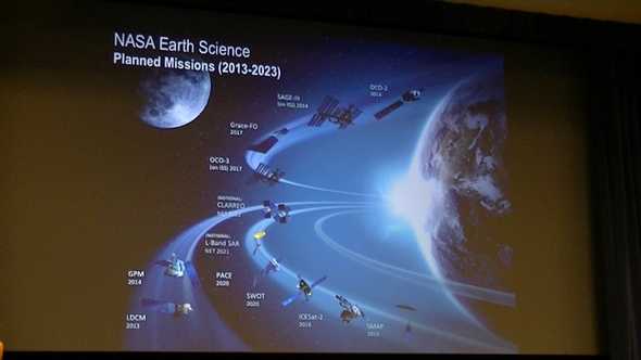
In the next ten years, planned missions include: Landsat Data Continuity Mission (LCDM) in 2013; Global Precipitation Measurement (GPM), Soil Moisture Active-Passive (SMAP), Stratospheric Aerosol and Gas Experiment III - International Space Station (SAGE-III), Orbiting Carbon Observatory (OCO-2) in 2014; Orbiting Carbon Observatory – 3 (OCO-3), Ice, Cloud, and land Elevation Satellite-2 (ICESat-2) in 2016; Grace Follow-On (Grace-FO) in 2017; Surface Water Ocean Topography (SWOT), Pre-Aerosol, Clouds, and ocean Ecosystem (PACE) in 2020; L-Band SAR in 2021; and Climate Absolute Radiance and Refractivity Observatory (CLARREO) in 2022.
Cyclone Global Navigation Satellite System (CYGNNS) in 2017, Tropospheric Emissions: Monitoring of Pollution (TEMPO) in 2019, EVI-1 in 2019, EVI-2 in 2020, EVM-2 in 2021, and EVI-3 in 2022 are part of NASA’s Earth Venture class program, which allows science ideas to come from the science community. Proposals come to NASA, are peer reviewed and are chosen base on how likely they are to succeed and give the best science in the long run. These are for both space missions and airborne observations.
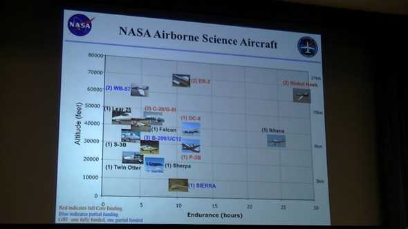
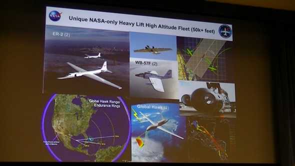
Aircraft that reach high altitude include the ER-2, WB-57F, and the Global Hawk.
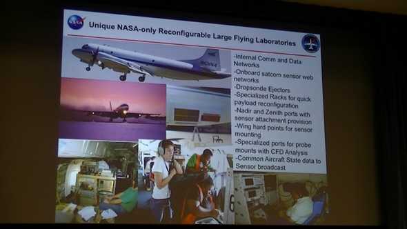
The DC-8 and P-3 are among the large aircraft fleet that can be reconfigured. They feature internal communications and data networks, onboard satcom sensor web networks, dropsonde ejectors, specialized racks for quick payload reconfiguration, Nadir and Zenith ports with sensor attachment provision, wing hard points for sensor mounting, specialized ports for probe mounts with CFD Analysis, and common Aircraft State data to Sensor broadcast.
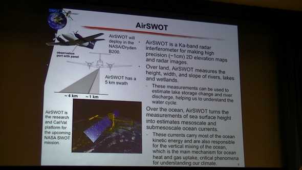
AirSWOT is a Ka-band radar interferometer with a swath of 5km, for making high precision (~1cm) 2D elevation maps and radar images. Over land, it measures the height, width, and slopes of rivers, lakes and wetlands, which can be used to estimate lake storage change and river discharge, helping to understand the water cycle. Over the ocean, it turns the measurements of sea surface height into estimates of the mesoscale and submesoscale ocean currents. These currents carry most of the ocean kinetic energy and are also responsible for the vertical mixing of the ocean which is the main mechanism for ocean heat and gas uptake, a critical phenomena for understanding our climate. AirSWOT will be deployed in the B200. This instrument will help design technology and develop science capabilities for a satellite mission being launched at the end of the decade.
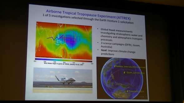
One of the Earth Venture 1 solicitations selected is the Airborne Tropical Tropopause Experiment (ATTREX). ATTREX will fly on the Global Hawk investigating stratospheric water and chemistry and atmospheric transport processes to improve climate change predictions.
The space missions launched have a two to five year life span. Some missions replace previous missions with advanced technology. When a science returns from a mission degrades, it is replaced and not repaired. Much of the experimental technology is first tested on aircraft to work out any bugs.

